Verisat emerges to combat a critical new threat: AI-generated satellite imagery manipulations nearly indistinguishable from reality. This technology addresses escalating risks in defense, journalism, and environmental monitoring where forged geospatial data could have catastrophic consequences. The platform promises high-accuracy detection in under two seconds, signaling a new arms race in visual truth verification.
The silent revolution in generative AI has reached orbit. A new breed of threat now targets one of our most trusted sources of objective reality: satellite imagery. Start-up Verisat has stepped into this critical breach, launching technology designed to detect AI-manipulated satellite photos with reported 89.7% accuracy in under two seconds.
The Invisible Threat: Beyond Photoshop
Unlike crude forgeries of the past, modern AI tools can alter satellite images with terrifying subtlety – adding or removing critical infrastructure, changing terrain features, or fabricating entire events. These manipulations are often imperceptible to the human eye and designed to deceive automated analysis systems. The implications are profound:
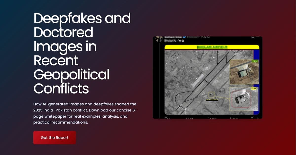
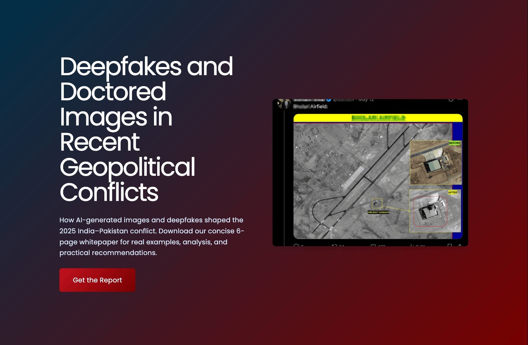
- Conflict Zones: Fabricated troop movements or destroyed infrastructure could provoke real-world military escalations (as hinted in Verisat's research on Pakistan-India tensions).
- Environmental Monitoring: Illicit deforestation or pollution could be masked, undermining climate accords and conservation efforts.
- Journalism & Human Rights: Trust in visual evidence from inaccessible or restricted regions could collapse.
- Supply Chain & Logistics: Falsified port activity or infrastructure damage reports could disrupt global operations.
How Verisat Promises to Fight Back
Verisat's approach combines multiple detection layers, moving beyond simple pixel analysis:
- Forensic Analysis: Scrutinizing the digital 'fingerprint' of the image file for inconsistencies introduced by generative AI models, examining compression artifacts, noise patterns, and sensor metadata anomalies.
- Contextual Verification: Cross-referencing imagery with trusted historical data, other sensor feeds (where available), and known geographical constraints to identify physically impossible alterations.
- AI-Powered Pattern Recognition: Utilizing specialized neural networks trained specifically on the unique artifacts left by satellite image manipulation techniques.
"Verisat makes satellite image verification simple: just upload your image or connect a data feed, and our AI instantly analyzes it for signs of manipulation... flagging images as real, fake, or pending review." – Verisat
The platform boasts API readiness and integrates with major cloud providers (AWS, Azure, GCP), aiming for seamless adoption within existing geospatial data pipelines used by defense, intelligence, media, and environmental organizations currently in its private beta.
The Escalating Arms Race in Geospatial Truth
Verisat's emergence underscores a critical inflection point. As generative models like diffusion networks become more sophisticated, the ability to create convincing synthetic or altered satellite imagery is no longer science fiction. This creates a fundamental challenge for any decision-making process reliant on geospatial intelligence. Verisat represents a crucial countermeasure, but its launch is just the opening salvo in an ongoing battle between deception and verification technologies. The integrity of our view from space – once taken for granted – now requires vigilant, AI-powered guardianship. The stakes for global security, environmental accountability, and factual reporting have never been higher.
Comments
Please log in or register to join the discussion