The U.S. Department of Defense has reversed its controversial decision to halt the sharing of vital satellite weather data, crucial for hurricane tracking and climate monitoring, following significant backlash from scientists and forecasters. This data, processed by the Navy's Fleet Numerical Meteorology and Oceanography Center, will now remain available until at least September 2026, averting a potential crisis in forecast accuracy during peak hurricane season.
In a significant policy reversal, the U.S. Department of Defense (DoD) has announced it will continue providing critical satellite-derived weather data to civilian scientists and meteorologists, staving off fears of degraded hurricane forecasts and climate monitoring capabilities. This decision comes just weeks before the peak of the Atlantic hurricane season and follows intense pressure from the scientific community.
Modernization Plan Sparks Alarm
The Navy's Fleet Numerical Meteorology and Oceanography Center (FNMOC), responsible for processing and disseminating this data stream, had initially planned to phase out access as part of a broader Defense Department modernization effort. A Navy spokesperson confirmed to NPR that the phase-out was scheduled to begin imminently, potentially crippling real-time storm tracking capabilities.
"After feedback from government partners, officials found a way to meet modernization goals while keeping the data flowing until the sensor fails or the program formally ends in September 2026," the spokesperson stated.
This data, sourced from specific DoD-operated satellites, provides unique, high-resolution measurements of atmospheric and oceanic conditions over vast swaths of the globe, particularly crucial regions where storms rapidly intensify. For over four decades, this information has been foundational for agencies like the National Oceanic and Atmospheric Administration (NOAA).
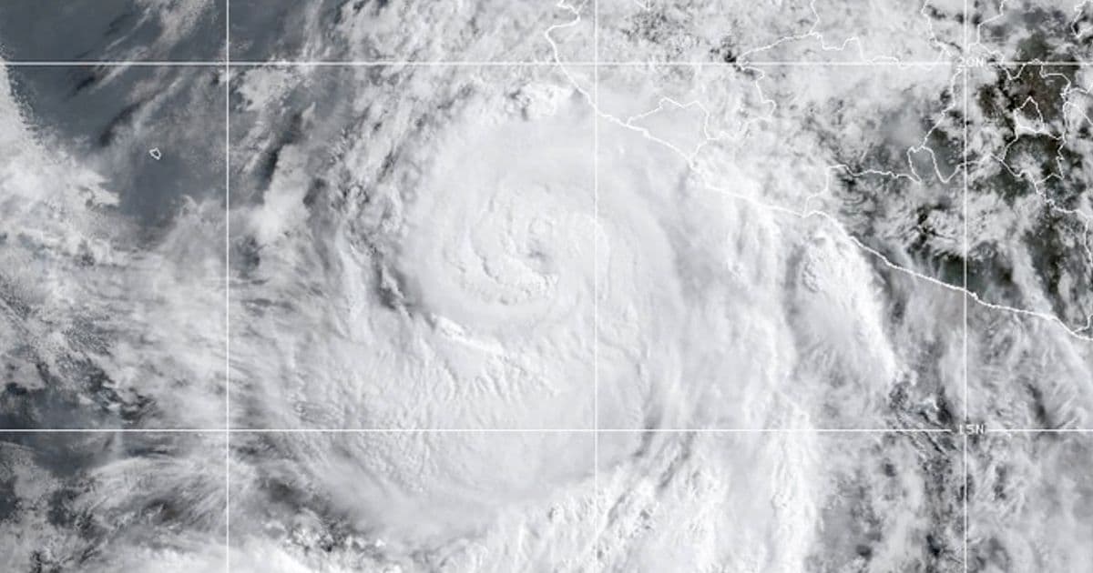
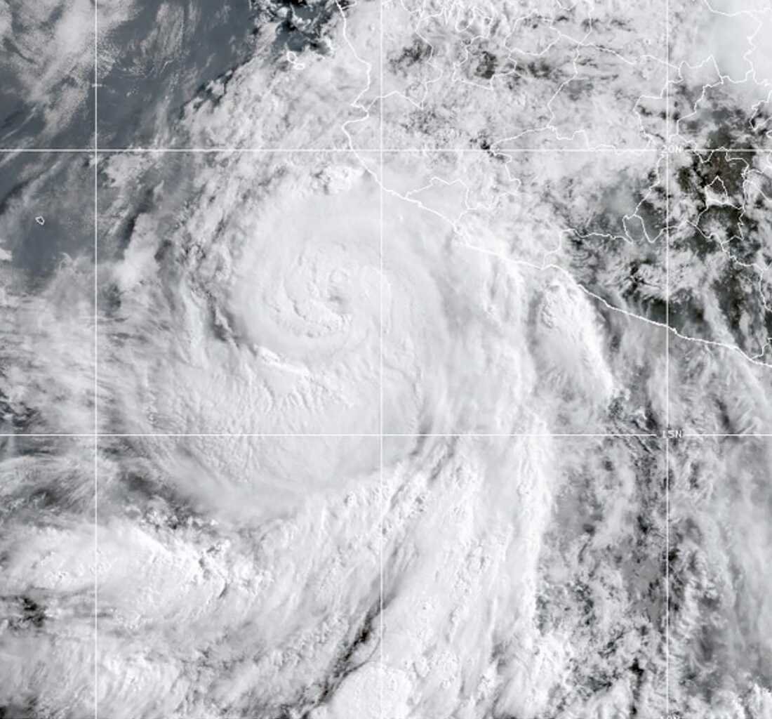 A satellite image of Hurricane Flossie on July 1, 2025, captured using the type of data the DoD will continue providing. Forecasters rely on this real-time information to track storm development. (Credit: AP/NOAA)
Vital for Forecasting and Climate Science
The potential loss of this data stream sparked immediate concern among experts. Dr. Brian Tang, a hurricane researcher at the University at Albany, emphasized its irreplaceable role: "It's vital that the data continue to be available through the heart of the Atlantic hurricane season... Tracking storms as they gather strength allows forecasters to put out warnings earlier, giving people in harm's way more time to prepare and evacuate."
The data's importance extends far beyond hurricane tracking. It is also essential for:
- Monitoring Polar Sea Ice: Critical for understanding Arctic weather patterns, navigation safety for international shipping, and assessing the accelerating impacts of climate change.
- Global Weather Models: Feeding into the complex numerical models used for daily weather predictions worldwide.
- Long-Term Climate Records: Providing consistent, long-term datasets essential for detecting climate trends.
A Temporary Reprieve, Long-Term Uncertainty
While the reversal provides immediate relief, it is framed as a temporary solution. The Navy had already delayed the initial cutoff date once (from end-June to end-July) following scientific outcry. The new agreement ensures data flow only until the sensor fails or the program officially terminates in September 2026. The fate of this critical environmental monitoring capability beyond that date remains uncertain, leaving the scientific and forecasting communities facing a similar cliff-edge scenario in just over a year. The pressure now shifts to finding a permanent solution for maintaining access to this unique observational stream vital for public safety and understanding our changing planet.
Source: Based on reporting by Rebecca Hersher for NPR (July 31, 2025).
Comments
Please log in or register to join the discussion