A hidden Google Maps feature allowing users to view historical Street View imagery is going viral, enabling emotional reunions with lost loved ones and past memories. We explore the technical workings and cultural impact of this digital time capsule.
Google Maps' Hidden Time Machine: The Tech Behind the Viral Nostalgia Trend
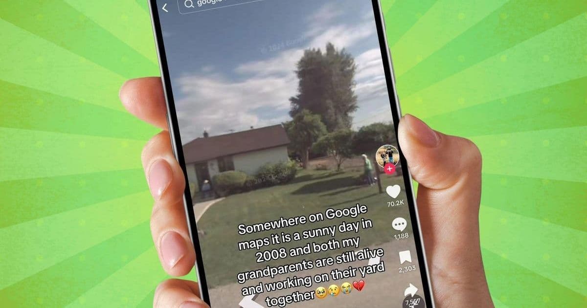
A quiet feature in Google Maps is triggering emotional responses worldwide as users discover they can revisit past versions of their homes through historical Street View imagery. The "See More Dates" functionality has become a viral sensation on TikTok, with people sharing tearful moments when they spot deceased relatives in old driveway shots or childhood versions of themselves playing outside.
How the Street View Time Travel Works
Google's Street View technology captures 360-degree imagery using specialized camera systems mounted on vehicles, bicycles, and even backpacks. These images are geotagged and timestamped, creating a massive historical archive of locations worldwide since the program's 2007 launch.
The technical magic happens through:
- Multi-layered imagery storage: Google stores petabytes of historical imagery in its cloud infrastructure
- Precise geolocation alignment: Images are algorithmically matched to exact coordinates using GPS data
- Timeline indexing: Metadata organizes captures by date, enabling chronological browsing
{
  "feature": "See More Dates",
  "first_released": 2014,
  "mobile_expansion": 2022,
  "data_sources": ["Street View cars", "trekkers", "user contributions"],
  "oldest_imagery": "May 2007"
}
Step-by-Step: Accessing Your Digital Past
- Access Google Maps via web (google.com/maps) or mobile app (iOS/Android)
- Enter target address in the search bar
- Activate Street View by dragging Pegman onto the map
- Tap "See More Dates" (clock icon on desktop, bottom panel on mobile)
- Select historical captures from the timeline interface
"The engineering challenge wasn't just capturing the images, but making them discoverable across decades of technological change," explains a former Google Geo team member. "The timeline feature required rebuilding our spatial indexing systems."
Technical Limitations and Privacy Safeguards
While emotionally powerful, the feature has technical constraints:
- Coverage gaps: Only 58% of populated areas have historical coverage
- Temporal resolution: Rural areas might have years between captures
- Automatic blurring: License plates and faces are obscured using computer vision algorithms
- Removal protocols: Users can request image takedowns via Google's privacy tools
Why This Resonates in the AI Era
This phenomenon highlights how "accidental archives" created for mapping have become unexpected emotional repositories. As TikTok user @Tyra__Lynn shared: "Seeing my dad watering plants seven years after he passed... it's like Google saved a piece of him for me."
The trend underscores:
- Unintended consequences of large-scale data collection
- Emotional value in persistent digital artifacts
- Technical debt opportunities: Old systems can yield new utilities
- Generational preservation: Digital anthropology through commercial platforms
Source: ZDNET, Google Maps documentation, and TikTok trend analysis
Comments
Please log in or register to join the discussion