MIT researchers have created a new method to generate detailed, near real-time vehicle emissions data using existing traffic cameras and mobile phone data, enabling policymakers to measure the actual impact of transportation policies like congestion pricing.
A new study from MIT researchers demonstrates how existing urban infrastructure can be leveraged to create detailed, real-time maps of vehicle emissions at the street level. The work, published in Nature Sustainability, combines traffic camera footage with anonymized mobile phone location data to generate emissions estimates that are both highly granular and scalable across entire cities.
From Citywide Averages to Street-Level Precision
Traditional approaches to measuring urban vehicle emissions typically fall into two categories: broad citywide inventories that lack detail, or intensive studies tracking individual vehicles that don't scale well. The MIT team's method bridges this gap by using computer vision on existing traffic camera feeds to identify vehicle types and movement patterns, then combining this with mobile phone data to understand overall traffic flow.
The system can estimate emissions down to individual roads and specific hours of the day. "Our model, by combining real-time traffic cameras with multiple data sources, allows extrapolating very detailed emission maps, down to a single road and hour of the day," explains Paolo Santi, principal research scientist at the MIT Senseable City Lab and co-author of the study.
Privacy-Preserving Technology
Importantly, the method protects individual privacy. While the system uses computer vision to recognize vehicle types—categorizing them into 12 broad groups—it does not collect or process license plate numbers. The mobile phone data is also anonymized, ensuring that personal movement patterns remain confidential while still providing valuable aggregate traffic information.
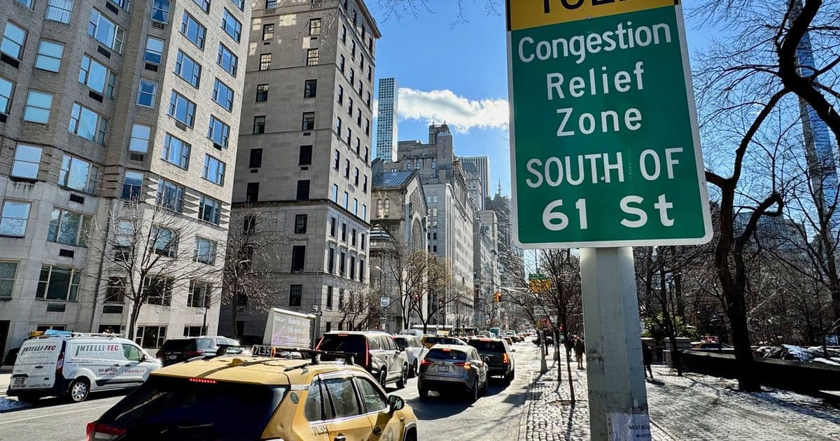
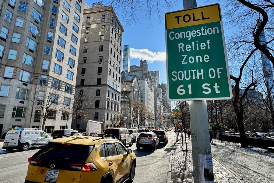
Testing the Model: New York City's Congestion Pricing
The researchers applied their method to study the effects of New York City's congestion pricing program, which began in January 2025 and charges fees for vehicles entering Manhattan south of 60th Street. By analyzing traffic patterns at intervals of two, four, six, and eight weeks after implementation, the team found that congestion pricing reduced traffic volume by approximately 10 percent.
More significantly, emissions dropped by 16-22 percent in the pricing zone. "We see these kinds of huge changes after the congestion pricing began," says Songhua Hu, former postdoc at the Senseable City Lab and now assistant professor at City University of Hong Kong. "I think that's a demonstration that our model can be very helpful if a government really wants to know if a new policy converts into real-world impact."
The Cost of Simplification
The study also revealed how simplifications in emissions modeling can lead to significant errors. When the researchers compared their detailed estimates against models using citywide average emissions rates, they found variations ranging from -49 percent to +25 percent. This demonstrates that seemingly small simplifications in data inputs can introduce substantial inaccuracies in policy assessments.
Beyond New York: Scalable Urban Intelligence
The method's scalability is one of its key advantages. The Manhattan study used data from 331 existing traffic cameras and over 1.75 million anonymized mobile phone location records. The researchers note that similar infrastructure exists in many cities worldwide, making the approach broadly applicable.
In related work in Amsterdam, the team has experimented with using dashboard camera footage from vehicles to further enhance their emissions mapping capabilities. "With our model we can make any camera used in cities, from the hundreds of traffic cameras to the thousands of dash cams, a powerful device to estimate traffic emissions in real-time," says Fábio Duarte, associate director of research and design at the Senseable City Lab.
Policy Applications and Future Directions
The granular emissions data enables policymakers to evaluate the effectiveness of various interventions. The researchers modeled several scenarios, including shifting travel demand from private vehicles to buses, spreading out rush hour peaks, and implementing different types of traffic management strategies. Each scenario produced distinct emissions patterns that could inform targeted policy decisions.
The work is part of the MIT Senseable City Lab's broader effort to develop hyperlocal environmental measurements. Carlo Ratti, director of the lab, notes that "by integrating multiple streams of data, we can reach a level of precision that was unthinkable just a few years ago—giving policymakers powerful new tools to understand and protect human health."
Technical Innovation Meets Practical Implementation
The study represents a convergence of several technological trends: the proliferation of urban cameras and sensors, advances in computer vision and machine learning, and the availability of anonymized mobility data. By combining these elements in a privacy-preserving framework, the researchers have created a tool that could transform how cities measure and manage their transportation emissions.
The research was supported by the MIT Senseable City Consortium, which includes partners from academia, government, and industry. As cities worldwide grapple with reducing transportation emissions while maintaining mobility, tools like this offer a path to evidence-based policymaking grounded in real-world data rather than assumptions.
The full paper, "Ubiquitous Data-driven Framework for Traffic Emission Estimation and Policy Evaluation," is available in Nature Sustainability and provides detailed methodology for cities interested in implementing similar systems.

Comments
Please log in or register to join the discussion