MIT Lincoln Laboratory's miniaturized microwave sounders, now deployed on shoebox-sized CubeSats, are providing unprecedented near-hourly data on rapidly intensifying storms, a capability previously impossible with traditional satellite technology. The technology, proven on NASA's TROPICS mission and now licensed to commercial firm Tomorrow.io, is expanding storm-forecasting capabilities for industries from aviation to emergency management.
Weather forecasting has long been a game of timing and data density. Traditional satellites in geostationary orbit provide broad, continuous views but at a coarse resolution, while polar-orbiting satellites offer finer detail but only pass over a given location twice a day. This leaves a critical gap: the ability to observe the rapid evolution of severe weather events like hurricanes and thunderstorms as they develop. A new generation of tiny satellites is now filling that gap, transforming how we monitor atmospheric phenomena.
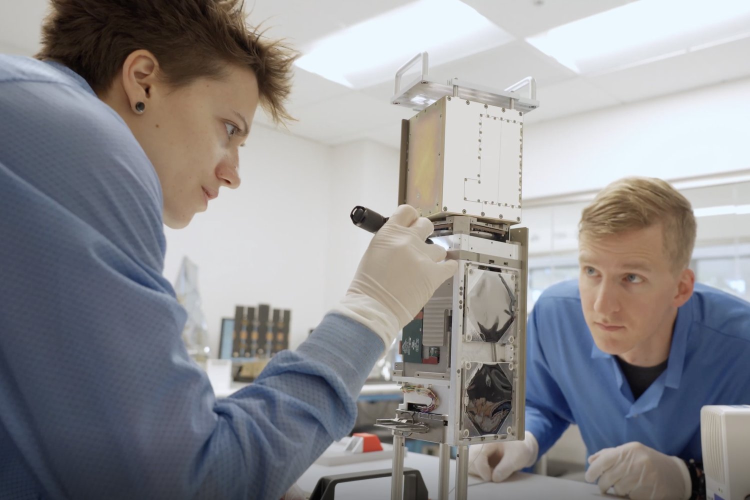
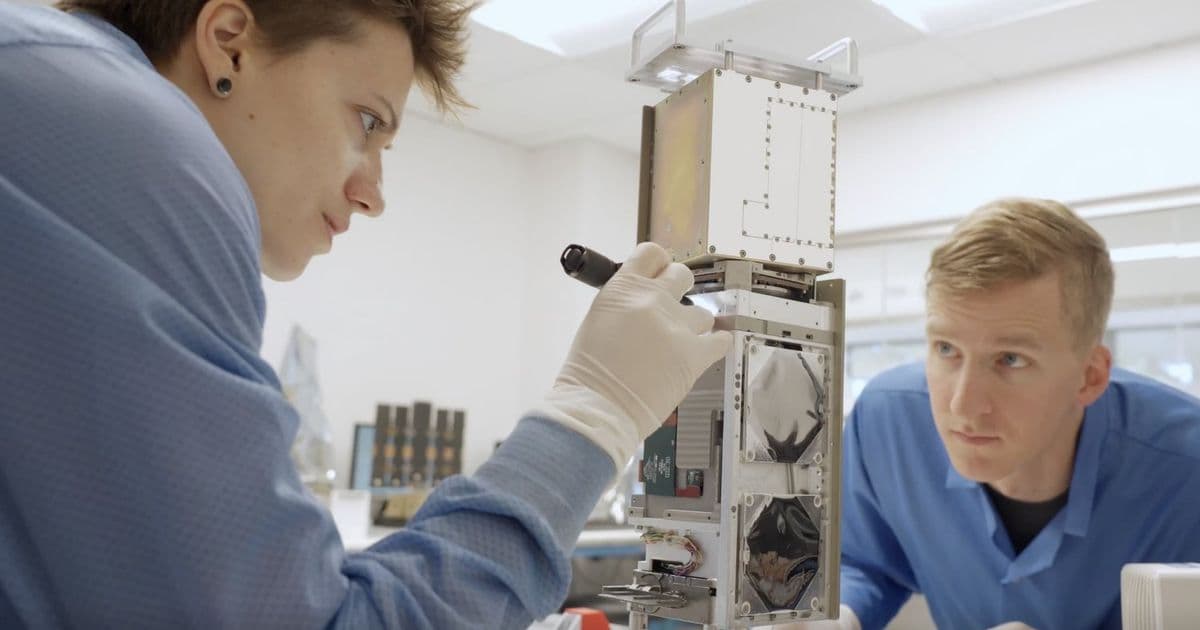
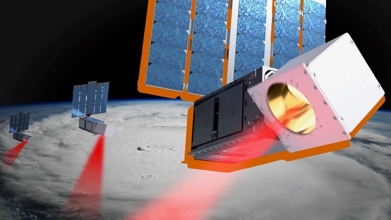
At the heart of this transformation is a technological breakthrough in miniaturization. MIT Lincoln Laboratory has developed microwave sounders that are one-hundredth the size of their traditional counterparts. These instruments, which measure atmospheric temperature, moisture, and water vapor, are small enough to fit on CubeSats—satellites the size of a shoebox. This scale shift is not merely about size; it enables a fundamental change in observation strategy.
From Monoliths to Constellations
Traditional weather satellites are massive, expensive platforms. A single geostationary satellite can cost billions of dollars and takes years to build and launch. Their large, powerful instruments provide excellent data but are limited in number. The Lincoln Laboratory team, led by researchers like Tim Briggs, recognized that a different approach was needed for observing fast-moving weather systems.
The solution was to trade the monolithic satellite for a distributed network. By launching a constellation of dozens of small satellites, each carrying a miniaturized sounder, the system can achieve a revisit time of nearly once per hour. This is a dramatic improvement over the 12-hour or longer gaps between observations from traditional systems. For a rapidly intensifying hurricane, which can strengthen from a Category 1 to a Category 4 in just 24 hours, this near-continuous data stream is invaluable.
The miniaturization process involved rethinking every component of the sounder. Traditional designs require large antennas and complex, power-hungry electronics. The Lincoln Laboratory engineers developed a novel architecture that integrates the antenna, receiver, and processing electronics into a compact package. The result is an instrument that weighs only a few kilograms and consumes minimal power—perfect for a CubeSat platform.
Proving the Concept: The TROPICS Mission
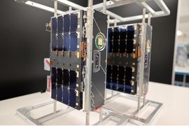
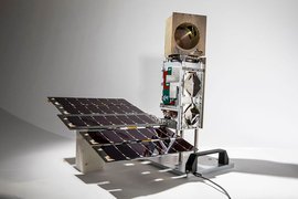
The technology's first major test was NASA's TROPICS (Time-Resolved Observations of Precipitation structure and storm Intensity with a Constellation of SmallSats) mission. TROPICS consisted of a constellation of six CubeSats, each equipped with Lincoln Laboratory's mini microwave sounder. Launched in 2023, the mission operated until 2025, providing an unprecedented dataset on tropical cyclones.
Over its operational lifetime, TROPICS collected over 11 billion observations. This wealth of data gave scientists their first detailed look at the internal structure of hurricanes as they undergo rapid intensification. Researchers could now correlate changes in temperature and moisture profiles with storm strength, improving the physical models used in forecasting.
The mission demonstrated that small satellites could deliver data quality comparable to much larger instruments. The sounders provided temperature soundings with an accuracy of about 1 Kelvin and moisture soundings with an accuracy of about 10%—sufficient for operational forecasting needs. More importantly, the constellation's rapid revisit rate allowed forecasters to see the evolution of storms in near-real time.
From Research to Industry: The Commercial Pathway
The success of TROPICS has paved the way for commercial application. The technology has been licensed to Tomorrow.io, a company specializing in weather intelligence and hyperlocal forecasting. This technology transfer represents a classic example of how government-funded research can catalyze private sector innovation.

Tomorrow.io is now developing its own constellation of satellites based on the TROPICS program. The company plans to expand the constellation's capabilities beyond tropical cyclones to include a wider range of weather phenomena. John Springman, Tomorrow.io's head of space and sensing, explains the strategic value: "Our overall goal is to fundamentally improve weather forecasts, and that'll improve our downstream products like our weather intelligence."
The commercial applications are diverse. Aviation companies can use the data to optimize flight paths around severe weather, reducing delays and fuel consumption. Logistics firms can reroute shipments to avoid storm-affected areas. Agricultural businesses can receive precise forecasts for irrigation and harvesting. Emergency management agencies can get earlier warnings for evacuation planning.
Technical Trade-offs and Limitations
While the technology represents a significant advancement, it comes with trade-offs. CubeSats have limited power and data transmission capabilities compared to larger satellites. The miniaturized sounders, while impressive, may not match the absolute accuracy of the largest traditional instruments. The small satellites also have shorter lifespans and are more vulnerable to space debris.
However, the constellation approach mitigates many of these limitations. If one satellite fails, the others continue to provide coverage. The distributed nature of the network also provides redundancy. The key insight is that for weather forecasting, data density and timeliness can be more valuable than ultimate instrument precision.
The Broader Impact on Weather Science
The deployment of these mini-satellite constellations is part of a larger shift in Earth observation. The traditional model of a few large, expensive satellites is giving way to networks of small, specialized satellites. This democratizes access to space and enables more frequent updates to our understanding of atmospheric processes.
For hurricane research specifically, the TROPICS data has already yielded new insights. Scientists have observed how small-scale features like eyewall replacement cycles—where a hurricane's inner eyewall collapses and is replaced by a new one—can dramatically affect storm intensity. These processes were difficult to observe with traditional satellites due to their infrequent sampling.
The technology also has implications for climate science. Long-term monitoring of atmospheric temperature and moisture profiles from a constellation of small satellites could provide valuable data for studying climate change trends, particularly in remote regions where ground-based observations are sparse.
Looking Ahead
The success of the Lincoln Laboratory sounders and their transition to commercial use suggests a promising future for small satellite-based weather observation. As launch costs continue to fall and satellite manufacturing becomes more standardized, we can expect to see more constellations dedicated to specific weather monitoring tasks.
Future developments may include adding more spectral bands to the sounders to measure additional atmospheric parameters, or integrating them with other instruments on the same satellite platform. The data processing pipeline will also need to evolve to handle the massive influx of observations from large constellations.
The collaboration between MIT Lincoln Laboratory, NASA, and commercial partners like Tomorrow.io demonstrates a effective model for technology transfer. Government research labs can develop and prove innovative concepts, while industry can scale them for broader application. This partnership accelerates the pace of innovation in weather forecasting and disaster preparedness.
As climate change increases the frequency and intensity of severe weather events, the need for better forecasting tools becomes more urgent. The miniaturized microwave sounders and the constellations they enable represent a practical, scalable solution to this challenge. By providing more timely and detailed observations of the atmosphere, these tiny satellites are helping to protect lives and property around the world.
The technology continues to evolve. Researchers at Lincoln Laboratory are already working on next-generation designs that are even smaller, more power-efficient, and capable of measuring additional atmospheric parameters. The goal is to create a versatile platform that can be adapted for various weather monitoring missions, from tracking hurricanes to monitoring atmospheric rivers that cause flooding.
For those interested in the technical details, the TROPICS mission documentation provides extensive information about the instrument design and data products. The TROPICS mission page offers access to datasets and scientific papers. The MIT Lincoln Laboratory website also features detailed descriptions of the sounder technology and its development history.
The transition of this technology from research to commercial application shows how innovation in autonomous systems and mechanical engineering can have direct, practical impact. The miniaturization of complex instruments, the design of robust satellite platforms, and the coordination of constellations all represent significant engineering achievements that are now delivering real-world benefits in weather forecasting and disaster management.
Comments
Please log in or register to join the discussion