
MIT researchers have developed a probability-based navigation system that directs drivers to optimal parking locations, reducing travel time by up to 35 minutes while cutting emissions from unnecessary cruising.

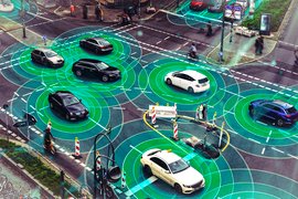
For urban drivers, the final minutes of any trip often transform into a frustrating game of parking roulette. Conventional navigation apps direct users to their destination while ignoring a critical variable: parking availability. This oversight leads to wasted fuel, increased emissions, and significant time loss as drivers circle blocks searching for spaces. MIT researchers have now developed a parking-aware navigation system that addresses this gap by incorporating probabilistic parking availability into route planning.
The Parking Probability Engine

The system's core innovation lies in its dynamic programming approach that calculates optimal parking decisions. Unlike traditional navigation that targets a destination, this method evaluates all nearby parking lots based on four key factors: driving distance from origin, walking distance to final destination, real-time parking availability probability, and the cascading effects of other drivers' parking behavior.
"Our framework doesn't just find the closest lot," explains lead researcher Cameron Hickert. "It identifies the parking location offering the best statistical balance between proximity and availability likelihood." The algorithm accounts for complex scenarios:
- Probability decay when multiple drivers target the same lot
- Spillover effects when failed parkers flood adjacent lots
- Optimal fallback strategies when primary lots are full
Using backward induction from successful outcomes, the system calculates the route with the lowest expected total time (driving + parking + walking). In simulated tests using Seattle traffic data, this approach reduced total travel time by up to 66% in congested areas compared to conventional methods.
Data Pipeline for Real-World Deployment
A critical challenge is sourcing accurate parking data. While some lots use sensors, the team demonstrated that crowdsourced data could achieve viable accuracy:
- Mobile app inputs from drivers reporting parking status
- Vehicle trajectory patterns indicating circling behavior
- Entry/exit rates at parking facilities
- Future potential: Autonomous vehicles reporting spotted vacancies
Simulations showed crowdsourced data achieved approximately 93% accuracy compared to ground-truth parking availability. "Even simple user inputs like tapping 'no parking' in an app could create powerful real-time datasets," notes Hickert.
Environmental and Behavioral Impact

The transportation implications extend beyond convenience. By minimizing unnecessary cruising:
- Emissions reduction: Less fuel burned during parking searches
- Transit competitiveness: Accurate total travel time estimates make public transit comparatively more attractive
- Congestion mitigation: Reduced vehicle miles traveled in dense urban cores
"Current systems systematically underestimate driving times by ignoring parking," emphasizes Professor Cathy Wu. "This prevents informed choices about transportation modes. Our approach offers a small change with potential for significant system-wide impact."
Implementation Roadmap
The team plans larger city-scale trials using real-time routing data. Future research avenues include:
- Satellite imagery analysis for parking occupancy detection
- Emissions quantification from reduced cruising
- Integration with municipal parking infrastructure
- Adaptive learning for dynamic pricing zones
While not yet commercially deployed, the framework demonstrates how probabilistic modeling can solve tangible urban mobility challenges. As cities prioritize sustainability, such parking-aware systems could become essential components of smart transportation networks.
Research Paper: Probability-Aware Parking Selection MIT Lab: Laboratory for Information and Decision Systems
Comments
Please log in or register to join the discussion