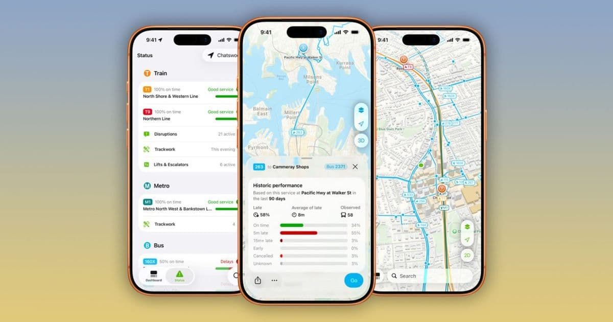
NextThere’s latest 4.1 update adds departure analytics, a live vehicle map, historic delay stats and expanded coverage across the US, Canada and Oceania, turning a simple transit app into a powerful planning tool for tourists and commuters.
Announcement
The indie team behind NextThere just rolled out version 4.1, a substantial upgrade that transforms the app from a basic schedule viewer into a data‑driven transit companion. The update lands on the App Store for iPhone, iPad and Apple Watch (iOS 15.6+), and adds a suite of new visualizations, historic performance metrics and broader city coverage.
Key features
1. Real‑time vehicle map & trace view
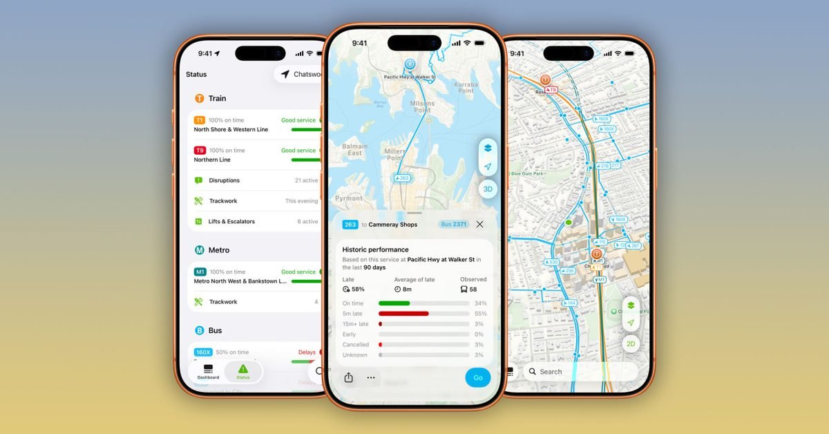
NextThere now overlays live bus and train positions on the route map. A tap on any icon opens a trace view that draws the vehicle’s exact path over the past few minutes, highlighting slow‑downs, traffic jams or detours. The map updates every few seconds, giving you a sense of how far a bus really is from your stop – a step beyond the static arrival times most map apps provide.
2. Departure analytics & historic performance
The app pulls several months of GTFS‑Realtime data and aggregates it into easy‑to‑read statistics:
- On‑time percentage for each line (e.g., 78 % of Route 42 buses arrive within five minutes of schedule)
- Average delay per stop, broken down by time of day and day of week
- Peak‑hour slowdown heatmaps that show where congestion typically occurs
These insights help commuters choose the most reliable routes and let tourists avoid lines that historically run late.
3. Expanded city roster
Originally limited to Australia and New Zealand, NextThere now supports a curated set of US markets:
- New York City, Los Angeles, Boston, Chicago, San Francisco Bay Area, Portland, Seattle, Washington state, Hawaii, North Carolina
- Plus Ontario, Canada
While major metros like Atlanta, Washington DC and Philadelphia are still missing, the app’s city‑specific data models mean each supported region receives detailed stop‑level information rather than a one‑size‑fits‑all experience.
4. Widgets, Live Activities and push notifications
A compact Home‑screen widget shows the next three arrivals for a selected stop, while a Live Activity on the lock screen keeps a countdown ticking down to the next vehicle. Push notifications can be tuned to alert you when a chosen line is experiencing unusually long delays or when a vehicle is approaching your stop in real time.
5. Pro subscription
The free tier gives you basic real‑time arrivals and the vehicle map. NextThere Pro unlocks:
- Full historic performance dashboards
- Unlimited vehicle trace history
- Customizable notification rules
- Access to the web portal for quick look‑ups on any device
Pricing is $1.99 / month, $12.99 / year for individuals, or $19.99 / year for families.
Ecosystem context
NextThere leans heavily on Apple’s transit‑focused APIs. It consumes GTFS‑Realtime feeds via the MapKit and CoreLocation frameworks, then layers its own analytics on top. The app’s Live Activities and widget support showcase how iOS 17’s background execution model can keep transit data fresh without draining battery.
Because the service runs on iOS, iPadOS and watchOS, users can start a trip on their phone, glance at the next arrival on their watch, and later review historic delay charts on an iPad. This cross‑device continuity is a classic strength of Apple’s ecosystem and makes NextThere feel like a native part of the platform rather than a third‑party add‑on.
From a lock‑in perspective, the app does not require a separate account; it uses the Apple ID for subscription billing, which simplifies the upgrade path but also ties the service to the Apple ecosystem. Users on Android will need to rely on the web version, which offers only real‑time arrival data and lacks the richer analytics.
Who will benefit?
- Tourists can plan routes around historically slow segments, avoiding known bottlenecks during rush hour.
- Daily commuters gain a clearer picture of which lines are reliably on time, allowing them to adjust their departure windows.
- Transit planners may find the public‑facing historic data useful for identifying chronic delays, though the app does not currently expose raw datasets for export.
Bottom line
NextThere’s 4.1 update proves that indie developers can still push sophisticated transit experiences on iOS. By combining live vehicle tracking, historic analytics and deep integration with widgets and Live Activities, the app offers a level of insight that most built‑in map solutions lack. If you rely on public transport in any of the supported cities, the free version is worth a download, and the Pro tier adds enough value to justify the modest subscription.
Check out the official NextThere App Store page for the latest version, and explore the web portal for quick look‑ups.
Comments
Please log in or register to join the discussion