DeFlock uses crowdsourced data to create a comprehensive map of ALPR locations, revealing the extent of automated license plate reader surveillance across American cities.
The proliferation of automated license plate readers (ALPRs) across American cities has largely occurred without public awareness or consent. Now, a new mapping project called DeFlock is bringing transparency to this surveillance infrastructure by crowdsourcing the locations of these devices.
ALPRs are high-speed cameras mounted on police vehicles, streetlights, and highway overpasses that capture license plate numbers, vehicle images, and timestamps. The data is typically stored in searchable databases that can track vehicle movements over time. While law enforcement agencies argue these tools help solve crimes, privacy advocates warn they enable mass surveillance of ordinary citizens.
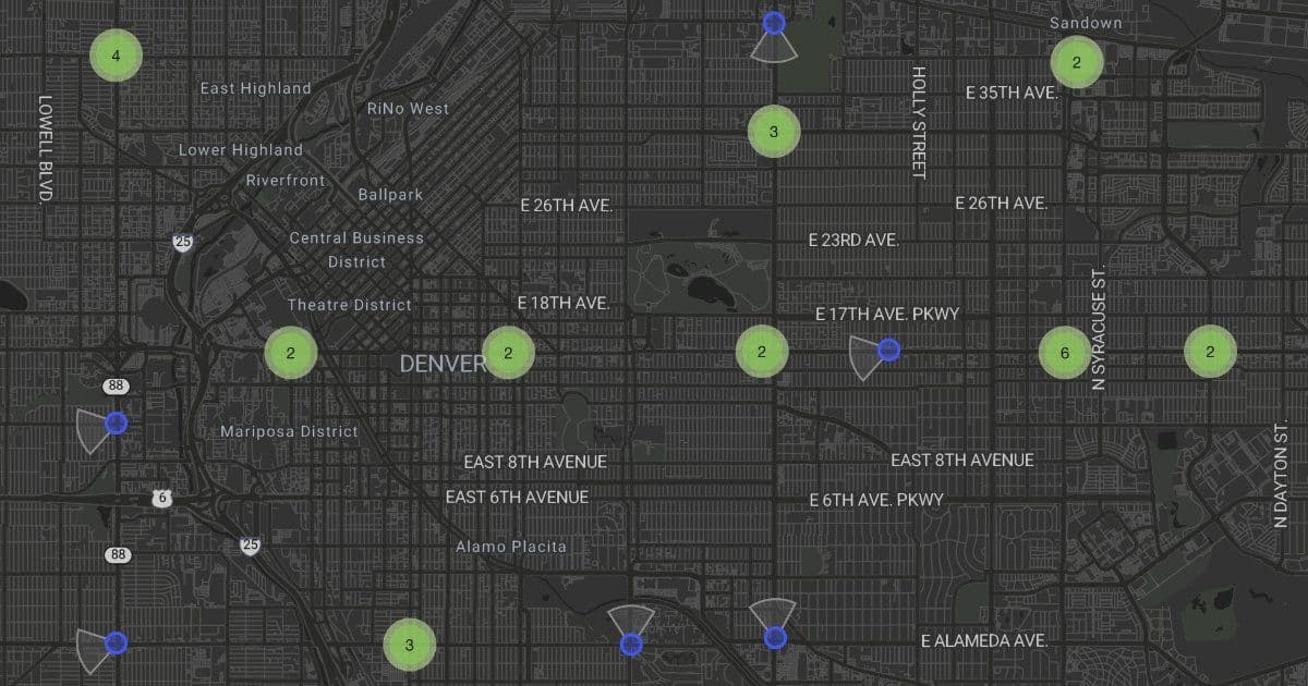
DeFlock's interactive map displays ALPR locations across the United States using data contributed by OpenStreetMap community members. The interface shows clusters of devices in major metropolitan areas, with individual points revealing the density of surveillance in specific neighborhoods. The map interface displays various ALPR groupings across different regions, with the legend indicating the number of devices in each cluster.
The project highlights how automated surveillance has become normalized in American policing. Cities like Los Angeles, New York, and Chicago show extensive ALPR coverage, with devices appearing not just in high-crime areas but throughout residential neighborhoods and commercial districts. The map reveals patterns that suggest systematic monitoring rather than targeted crime prevention.
What makes DeFlock particularly valuable is its crowdsourced approach. The project acknowledges that the map is incomplete and actively encourages public participation. Users can contribute missing ALPR locations, helping to create a more comprehensive picture of surveillance infrastructure. This participatory model turns passive surveillance subjects into active documentarians of the monitoring systems that track their movements.
The data powering DeFlock comes from OpenStreetMap contributors who have documented ALPR installations as part of broader mapping efforts. This community-driven approach provides a level of transparency that official sources rarely offer. While some law enforcement agencies publish ALPR locations, many keep this information secret, citing security concerns or operational effectiveness.
Privacy implications extend beyond law enforcement use. ALPR data is often shared between agencies and can be accessed by private companies. Insurance companies, repossession firms, and data brokers purchase access to these databases. The aggregated data can reveal intimate details about people's lives - their workplaces, religious institutions, medical facilities, and social connections.
DeFlock's existence raises important questions about the balance between public safety and privacy rights. The map serves as both a practical tool for understanding surveillance coverage and a form of resistance against unaccountable monitoring systems. By making ALPR locations visible, the project enables communities to have informed discussions about the surveillance infrastructure in their neighborhoods.
The project operates under a clear terms of service agreement, acknowledging the sensitive nature of mapping surveillance devices. Users must agree to terms before accessing the data, reflecting the complex legal and ethical considerations involved in documenting law enforcement technology.
As cities continue to expand their surveillance capabilities, tools like DeFlock become increasingly important for maintaining democratic oversight. The map demonstrates how crowdsourced data and open-source mapping can serve as counterweights to government and corporate surveillance, providing citizens with the information needed to understand and potentially challenge the monitoring systems that track their daily movements.

The interactive nature of DeFlock means the map will continue to evolve as more contributors add data. This living document of surveillance infrastructure provides an ongoing record of how automated monitoring systems spread across the American landscape, offering a crucial resource for privacy advocates, journalists, and concerned citizens seeking to understand the scope of modern surveillance.
Comments
Please log in or register to join the discussion